
Pa Lan Fm
Type Locality and Naming
Mae Hong Son basin (NW Thailand), near Myanmar, north of Mae Ping Fault. Named after Pa Lan village, Mueang Mae Hong Son district; type locality is a road cutting Km 8 and Km 9 along the unsealed road near Pa Lan village connecting the Mae Sariang – Mae Hong Son highway to Ban Palan and Ban Klang (grid reference 882104 on map sheet 4547-II). [Note: "Ban" is "village"]. Lower formation in the Huai Pong Gr.
Synonym: หมวดหินป่าลาน, Pa Lan Fm
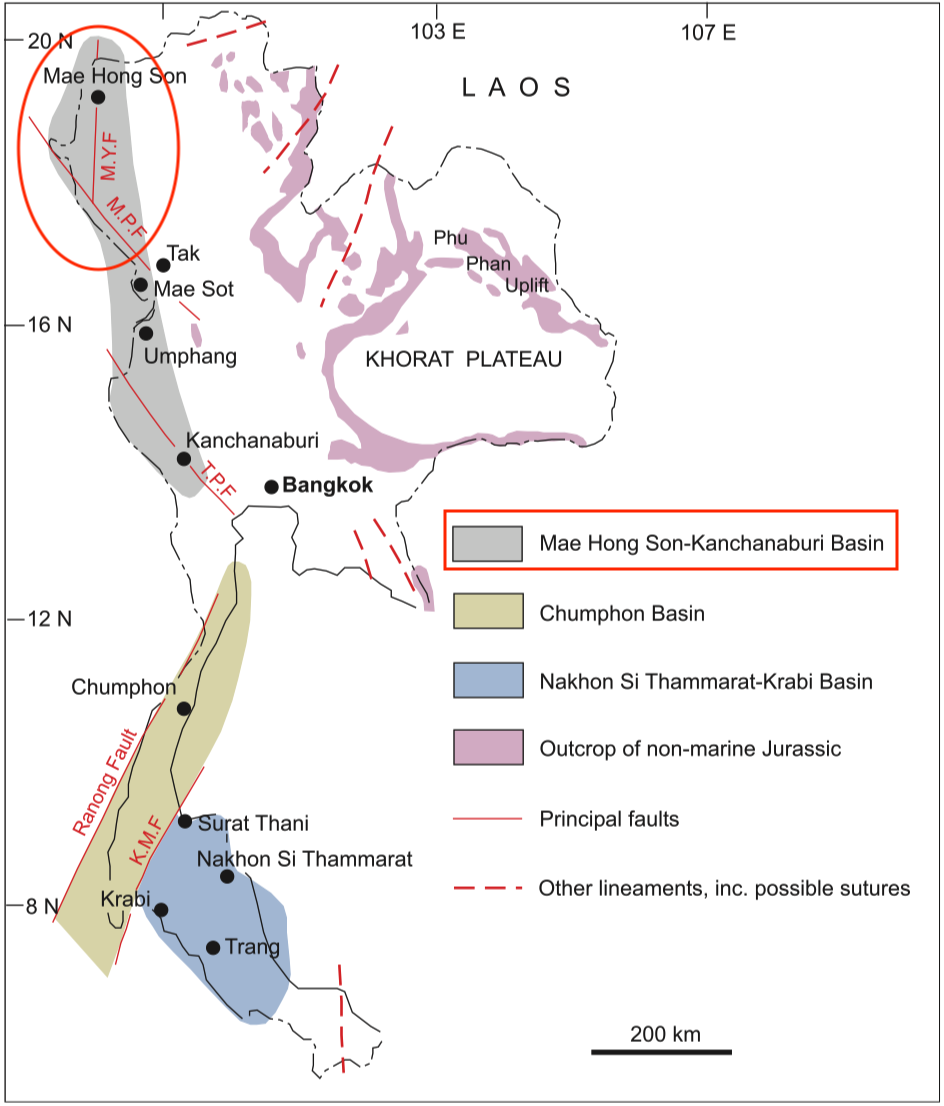
[Figure: The three sedimentary basins in which the marine Jurassic occurs, and their relationships to the main faults which might subsequently have displaced them (MYF, Mae Yuan Fault; MPF, Mae Ping Fault; TPF, Three Pagodas Fault; KMF, Khlong Marui Fault). The main outcrop areas of non-marine Jurassic rocks are also shown. In some areas, particularly on Peninsular Thailand, the Jurassic succession contains both marine and non-marine facies (redrawn from Meesook 1994; Charusiri et al. 2002, by Meesook A. & Saengsrichan W., 2011, Page 152).]
Lithology and Thickness
Alternating grey mudstone and subordinate thin-bedded sandstone. Thickness: 90 m in its type section.
Relationships and Distribution
Lower contact
"The relationship between this formation and older strata is uncertain because of inadequate exposure. Contacts with the Triassic strata are inferred both to be fault-bounded and also unconformable" (Ueno & Saengsrichan, 2011)
Upper contact
The upper contact is partly conformable with the Mai Hung Fm and partly unconformable with the Kong Mu Fm.
Regional extent
Mae Hong Son basin (northern part of Mae Hong Son – Kanchanaburi Basin); Northern Region: Mae Hong Son and Tak provinces
GeoJSON
Fossils
"Bivalves are abundant and ammonites are rare; the Toarcian age determination is based on the presence of the ammonite Dactyliocerus sp. and the bivalve Parvamussium donaiense Mansuy" (Meesook & Saengsrichan, 2011)
Age
Depositional setting
Shallow marine, neritic zone
Additional Information